Live
2018JUL
Lot 786
Sold
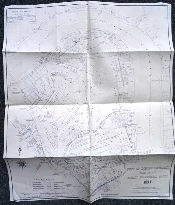
PORT OF LONDON AUTHORITY - Plan of the Surrey Commercial Docks, 1968. 52 x 43cms., b/w. on paper, scale: 400ft to inch; sold with PORT OF LONDON AUT
PORT OF LONDON AUTHORITY - Plan of the Surrey Commercial Docks, 1968. 52 x 43cms., b/w. on paper,…
Hammer price:
£10
Estimate: £40 - £50
1 July 2018
1 July 2018
Lot 792
Sold
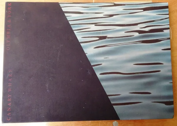
'CANARY WHARF' oblong folio of 24 (mostly) coloured plans & artist's impressions of completed buildings & areas, also 4 coloured photos. of constructi
'CANARY WHARF' oblong folio of 24 (mostly) coloured plans & artist's impressions of completed…
Hammer price:
£50
Estimate: £60 - £80
1 July 2018
1 July 2018
Lot 793
Sold
LONDON - A New Survey of the Environs of London . . . new edition, 56 x 69cms., hand-coloured, within marbled covers, folded on linen. Laurie & Whit
LONDON - A New Survey of the Environs of London . . . new edition, 56 x 69cms., hand-coloured,…
Hammer price:
£40
Estimate: £50 - £60
1 July 2018
1 July 2018
Lot 794
Sold
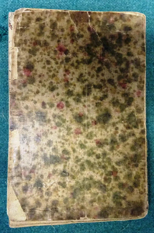
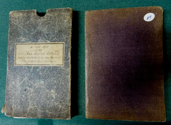
John WALLIS - The Country Twenty-Two Miles Round London, 60 x 59cms., hand-coloured, scale: half inch to mile, folded on linen, within marbled slipcas
John WALLIS - The Country Twenty-Two Miles Round London, 60 x 59cms., hand-coloured, scale: half…
Hammer price:
£110
Estimate: £60 - £100
1 July 2018
1 July 2018
Lot 795
Sold
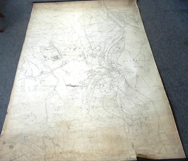
ORDNANCE SURVEY - Caterham & District; 25 inch to mile, sheet XXVII. 10; 220 x 144cms., linen backed on wooden rollers, revised 1895 (reprinted 1898).
ORDNANCE SURVEY - Caterham & District; 25 inch to mile, sheet XXVII. 10; 220 x 144cms., linen…
Hammer price:
£60
Estimate: £60 - £100
1 July 2018
1 July 2018
Lot 796
Sold
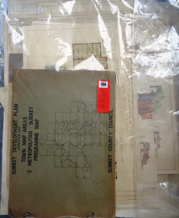
SURREY MISCELLANY - including Surrey Development Plan, 1953 (Town Map Areas); another (Approved 1958); 15 hand-coloured architects plans & elevations
SURREY MISCELLANY - including Surrey Development Plan, 1953 (Town Map Areas); another (Approved…
Hammer price:
£25
Estimate: £100 - £150
1 July 2018
1 July 2018

Lot 797
Sold
ORDNANCE SURVEY - 6 inches to mile series, mostly Surrey. approx. 50 loose sheets, 67 x 55cms., 1920s / 1960s editions / revisions.
ORDNANCE SURVEY - 6 inches to mile series, mostly Surrey. approx. 50 loose sheets, 67 x 55cms.,…
Hammer price:
£25
Estimate: £60 - £80
1 July 2018
1 July 2018

Lot 798
Sold
ORDNANCE SURVEY - 25 inches to mile series, mostly Surrey / Kent, including London environs. approx. 170 loose sheets, 75 x 45cms., mostly 1920s / 195
ORDNANCE SURVEY - 25 inches to mile series, mostly Surrey / Kent, including London environs. approx…
Hammer price:
£25
Estimate: £120 - £160
1 July 2018
1 July 2018

Lot 799
Sold
ORDNANCE SURVEY - 50 inches to mile series, mostly Surrey. approx. 80 loose sheets, 49 x 57cms., 1950s editions / revisions.
ORDNANCE SURVEY - 50 inches to mile series, mostly Surrey. approx. 80 loose sheets, 49 x 57cms.,…
Hammer price:
£25
Estimate: £100 - £140
1 July 2018
1 July 2018
Lot 801
Sold
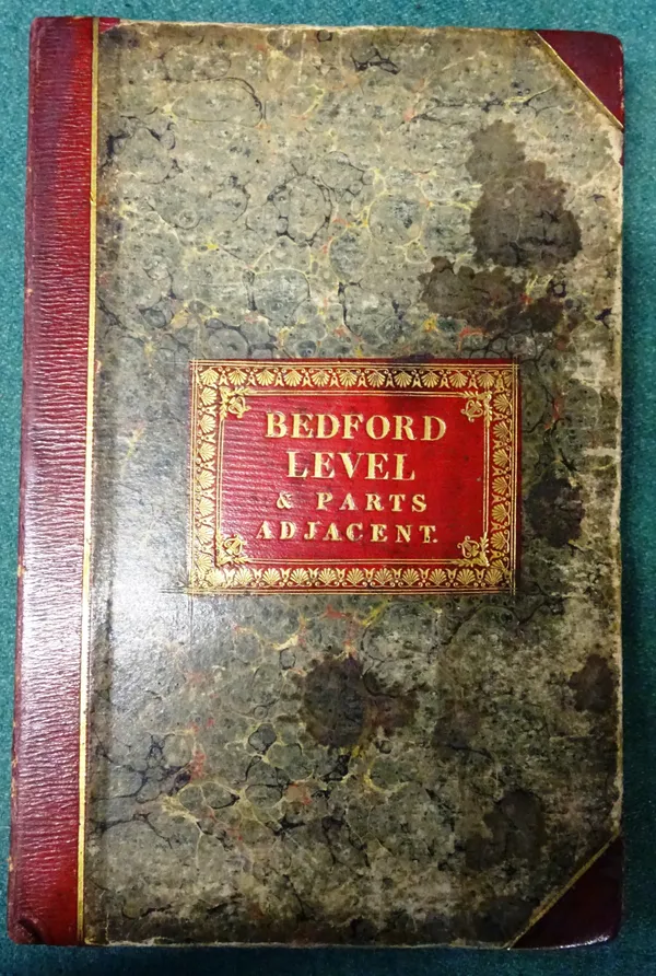
FENLAND - The Great Level of the Fens called Bedford Level. 81 x 79cms. within ruled borders, hand-coloured & folded on linen into half morocco & marb
FENLAND - The Great Level of the Fens called Bedford Level. 81 x 79cms. within ruled borders, hand…
Hammer price:
£190
Estimate: £160 - £200
1 July 2018
1 July 2018
Lot 804
Sold
MADRAS PRESIDENCY - District Maps. blue-printed, with key map & 22 d-page district maps, scale: 1 inch to 96 miles; black-lettered linen, 4to.(Madras
MADRAS PRESIDENCY - District Maps. blue-printed, with key map & 22 d-page district maps, scale: 1…
Hammer price:
£320
Estimate: £80 - £100
1 July 2018
1 July 2018
Lot 805
Sold
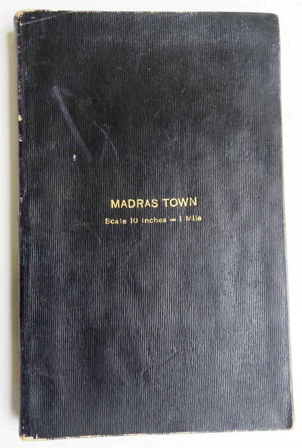
MADRAS TOWN - Topographical Map . . . blue printed, with d-page key map, title, reference & 46 d-page plans, scale: 10 inches to 1 mile; gilt-letter
MADRAS TOWN - Topographical Map . . . blue printed, with d-page key map, title, reference & 46 d…
Hammer price:
£1,200
Estimate: £120 - £160
1 July 2018
1 July 2018
Lot 806
Sold
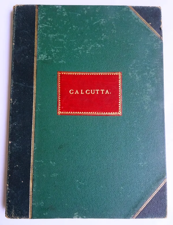
CALCUTTA Surveyed during the Years 1887-1894. 88 x 63cms., hand-coloured, scale: 6 inches to 1 mile, folded on linen, within half morocco & cloth cove
CALCUTTA Surveyed during the Years 1887-1894. 88 x 63cms., hand-coloured, scale: 6 inches to 1 mile…
Hammer price:
£1,700
Estimate: £80 - £100
1 July 2018
1 July 2018
Lot 807
Sold
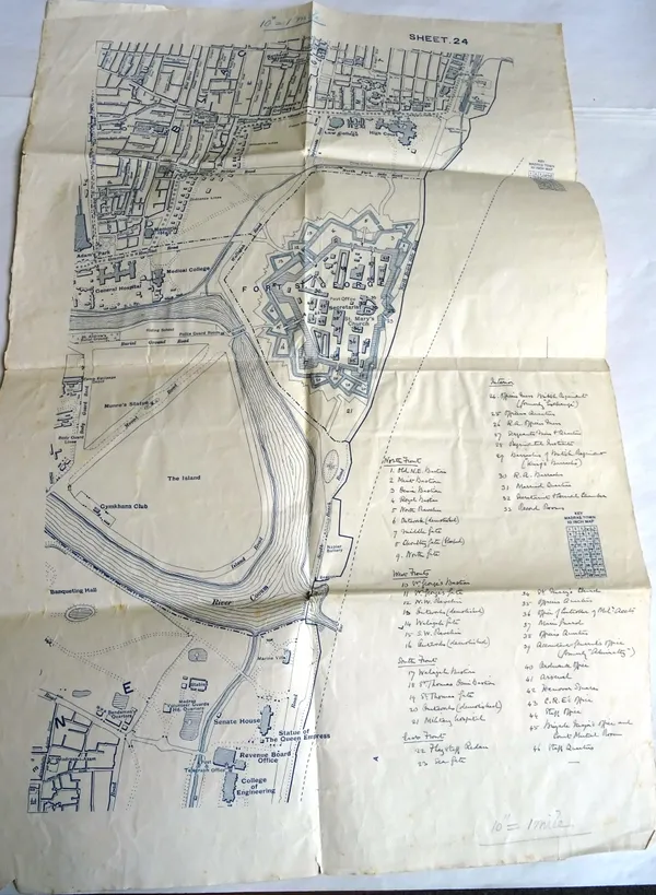
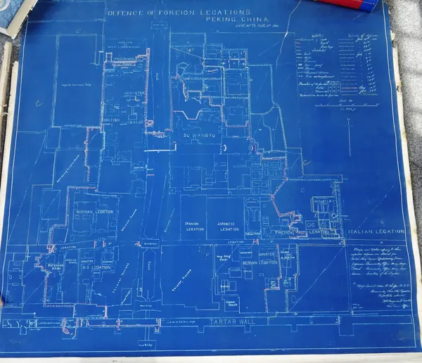
BOXER REBELLION - Coloured Plan Defence of Foreign Legations, Peking, China. June 20th - Aug 14th, 1900, 87 x 96cms., coloured in outline & printed on
BOXER REBELLION - Coloured Plan Defence of Foreign Legations, Peking, China. June 20th - Aug 14th,…
Hammer price:
£280
Estimate: £300 - £400
1 July 2018
1 July 2018
Lot 808
Sold
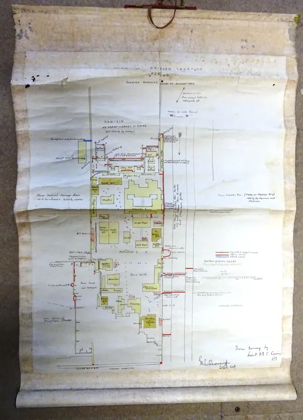
BOXER REBELLION - Plan of British Legation, Peking. Shewing Defences June - August 1900. hand-coloured & lithographed, 55 x 43cms., within silk border
BOXER REBELLION - Plan of British Legation, Peking. Shewing Defences June - August 1900. hand…
Hammer price:
£350
Estimate: £160 - £200
1 July 2018
1 July 2018
Lot 809
Sold
ADMIRALTY CHARTS - a large worldwide collection of approx. 80, mostly 71 x 104cms. (landscape) & 104 x 71cms. (portrait), some with outline colour, mo
ADMIRALTY CHARTS - a large worldwide collection of approx. 80, mostly 71 x 104cms. (landscape) &…
Hammer price:
£20
Estimate: £60 - £100
1 July 2018
1 July 2018
Lot 810
Sold
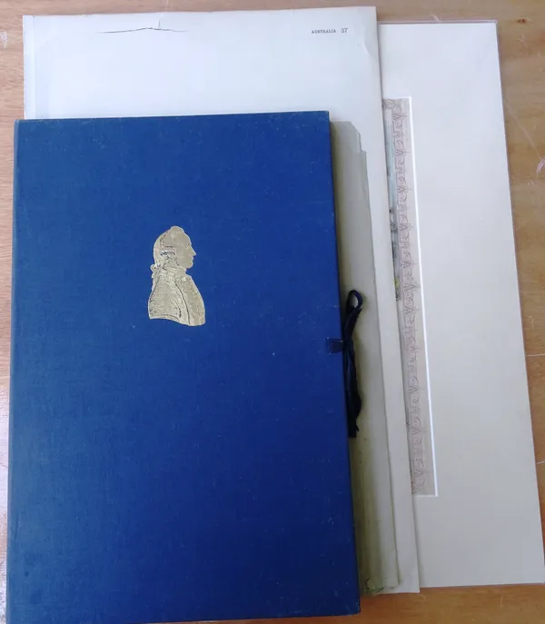
AUSTRALIA / POLYNESIA - includes New South Wales (Tallis, ca. 1855); Polynesia (Rapkin, ca. 1860); Australia (G.H. Johnston, ca. 1890): & also the Por
AUSTRALIA / POLYNESIA - includes New South Wales (Tallis, ca. 1855); Polynesia (Rapkin, ca. 1860);…
Hammer price:
£70
Estimate: £60 - £80
1 July 2018
1 July 2018
Lot 811
Sold
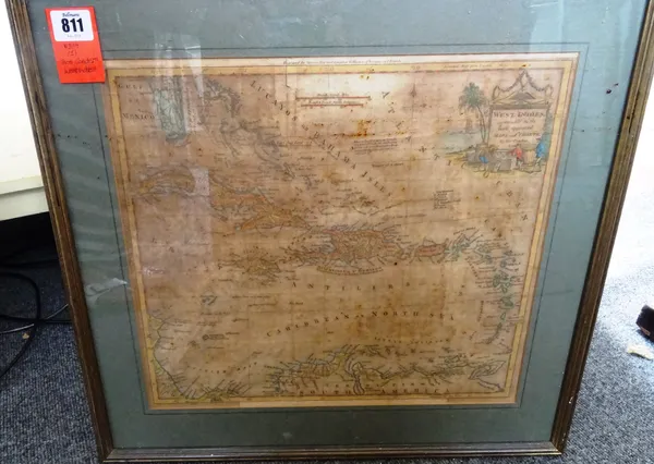
Thos. CONDER - West Indies, agreeable to the most approved maps and charts. 39 x 39cms. within mount, hand-coloured, pictorial engraved title, 1779.
Thos. CONDER - West Indies, agreeable to the most approved maps and charts. 39 x 39cms. within…
Hammer price:
£75
Estimate: £80 - £100
1 July 2018
1 July 2018
Lot 812
Sold
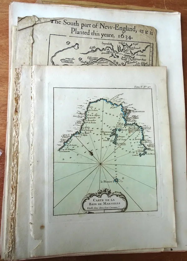
FRENCH COASTAL MAPS & PLANS - approx. 30, some with outline colour, loose,(early 19th century); sold with a few others.
FRENCH COASTAL MAPS & PLANS - approx. 30, some with outline colour, loose,(early 19th century);…
Hammer price:
£240
Estimate: £50 - £60
1 July 2018
1 July 2018
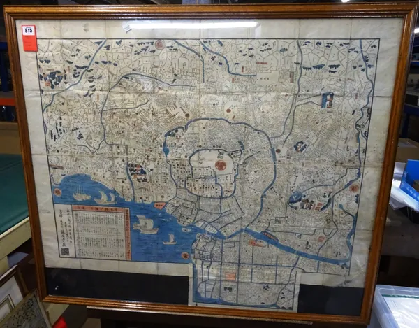
Lot 815
Sold
TOKYO (EDO) - Plan of the City, 80 x 95cms., (full-sheet), hand-coloured, reference key inset, (? Tokyo, 1845)
TOKYO (EDO) - Plan of the City, 80 x 95cms., (full-sheet), hand-coloured, reference key inset, (?…
Hammer price:
£320
Estimate: £200 - £300
1 July 2018
1 July 2018
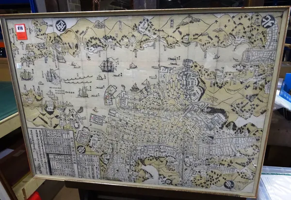
Lot 816
Sold
NAGASAKI - woodcut pictorial plan of the City & Port. 62 x 87cms., some background monochrome colouring, numerous ships within harbour, (ca. 1820). *
NAGASAKI - woodcut pictorial plan of the City & Port. 62 x 87cms., some background monochrome…
Hammer price:
£350
Estimate: £200 - £300
1 July 2018
1 July 2018
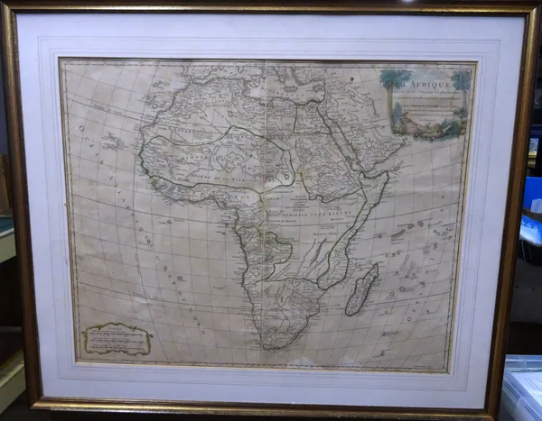
Lot 819
Sold
Robert de VAUGONDY - L'Afrique . . . 47 x 59cms., within mount, hand-coloured in outline, pictorial engraved title, engraved scale bars, Paris, 1756
Robert de VAUGONDY - L'Afrique . . . 47 x 59cms., within mount, hand-coloured in outline,…
Hammer price:
£20
Estimate: £60 - £80
1 July 2018
1 July 2018
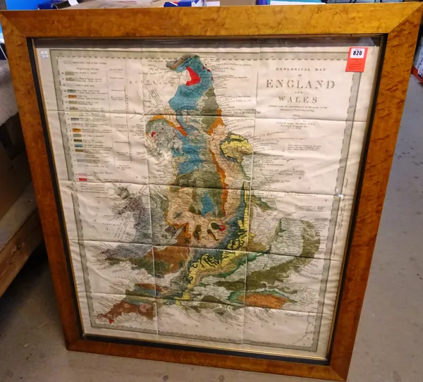
Lot 820
Sold
Roderick Impey MURCHISON - Geological Map of England and Wales . . . 103 x 89cms. (full-sheet within frame), lithographed & hand-coloured, engraved
Roderick Impey MURCHISON - Geological Map of England and Wales . . . 103 x 89cms. (full-sheet…
Hammer price:
£240
Estimate: £160 - £200
1 July 2018
1 July 2018
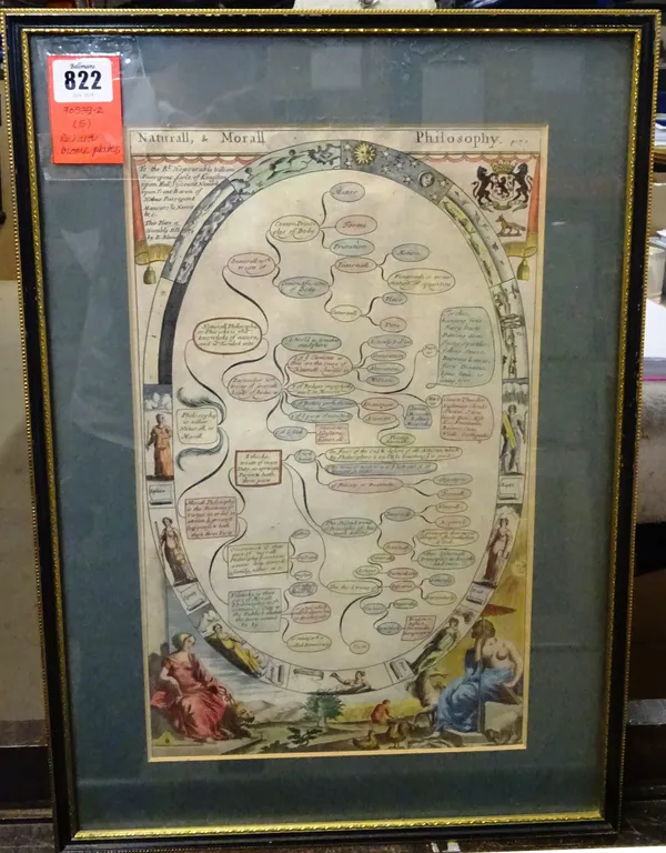
Lot 822
Sold
Richard BLOME - 5 framed plates from 'The Gentlemans Recreation . . . '; 38 x 23cms. (within mounts), hand-coloured, pictorial illus. in lower bord
Richard BLOME - 5 framed plates from 'The Gentlemans Recreation . . . '; 38 x 23cms. (within…
Hammer price:
£120
Estimate: £100 - £140
1 July 2018
1 July 2018